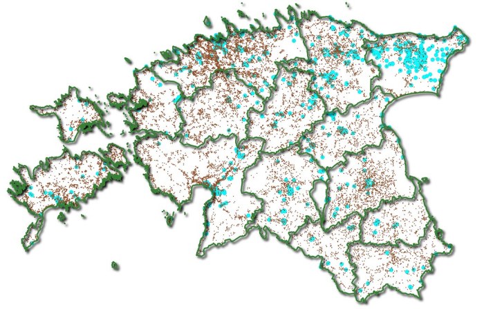
Welcome to the world of QGIS, where data analysis and visualization take center stage! QGIS free download opens the door to a world of possibilities, empowering you with tools to explore, analyze, and present geospatial data like never before.
From its humble beginnings to its current status as a leading open-source GIS software, QGIS has evolved into a robust platform trusted by professionals and enthusiasts alike. Join the thriving QGIS community and unlock the potential of geospatial analysis today!
Overview of QGIS

QGIS is an open-source geospatial analysis software that provides a wide range of capabilities for working with geographic data. With a user-friendly interface and extensive functionality, QGIS empowers users to visualize, analyze, and manage spatial information effectively.
Originally developed in 2002, QGIS has grown into a robust and widely used platform for geospatial analysis. Its open-source nature has fostered a vibrant community of developers and users, contributing to its continuous improvement and expansion of features.
Benefits of Using QGIS
- Open-Source and Free:QGIS is available for free, eliminating licensing costs and making it accessible to a wider user base.
- Extensive Functionality:QGIS offers a comprehensive suite of tools for data visualization, analysis, and management, catering to various geospatial applications.
- User-Friendly Interface:QGIS features an intuitive graphical user interface, making it easy for users to navigate and utilize its capabilities.
- Cross-Platform Compatibility:QGIS runs seamlessly on Windows, Mac, and Linux operating systems, providing flexibility and accessibility across different platforms.
- Active Community Support:QGIS benefits from a dedicated community of users and developers, offering support, resources, and contributions to its ongoing development.
Downloading and Installing QGIS

Downloading and installing QGIS is a straightforward process. Here’s a step-by-step guide to help you get started:
Step 1: System Requirements
Before downloading QGIS, make sure your system meets the following minimum requirements:
- Operating System: Windows 7 or later, macOS 10.10 or later, or Ubuntu 16.04 or later
- Processor: 2 GHz dual-core processor
- RAM: 4 GB
- Storage: 1 GB of available disk space
- Display: 1024 x 768 resolution
Step 2: Download QGIS, Qgis free download
To download QGIS, visit the official website at https://www.qgis.org/en/site/. Click on the “Download QGIS” button and select the appropriate version for your operating system.
If you’re looking for a free and open-source GIS software, QGIS is a great option. It’s packed with features that rival commercial software, and it’s constantly being updated with new features and improvements. And if you’re looking for a way to watch free movies on your Android device, be sure to check out our list of free apk movies . We’ve got all the latest and greatest movies, so you’re sure to find something you’ll enjoy.
And don’t forget to come back to QGIS when you’re ready to get back to work!
Step 3: Install QGIS
Once the download is complete, run the installation file and follow the on-screen instructions. Accept the license agreement and choose the installation directory. By default, QGIS will be installed in the “C:\Program Files\QGIS 3.26.3” directory on Windows systems.
Step 4: Plugins and Extensions
QGIS offers a wide range of plugins and extensions that can enhance its functionality. These plugins can be installed from the QGIS Plugin Repository. To install a plugin, go to the “Plugins” menu in QGIS and click on “Manage and Install Plugins”.
Search for the desired plugin and click on the “Install” button.
Using QGIS for Data Analysis
QGIS is a powerful tool for data analysis, allowing users to import, manage, and analyze geospatial data. With its user-friendly interface and extensive plugin library, QGIS makes it easy to perform spatial queries, statistical analysis, and create visually appealing maps and charts.
Importing and Managing Geospatial Data
QGIS supports a wide range of geospatial data formats, including shapefiles, GeoJSON, and raster images. Users can easily import data from local files, databases, or web services. QGIS provides tools for managing data, such as creating new layers, merging datasets, and performing spatial operations.
Tools and Techniques for Data Analysis
QGIS offers a comprehensive set of tools for data analysis, including:
- Spatial queries:Users can perform spatial queries to select features based on their location, geometry, or attributes.
- Statistical analysis:QGIS provides tools for calculating summary statistics, performing hypothesis testing, and generating statistical reports.
- Visualization:QGIS allows users to create maps, charts, and other visualizations to explore and communicate data patterns.
Real-World Applications
QGIS has been used in a wide range of real-world applications for data analysis, including:
- Land use planning:QGIS helps planners analyze land use patterns, identify potential development areas, and assess environmental impacts.
- Natural resource management:QGIS is used to analyze wildlife habitat, assess water quality, and monitor deforestation.
- Public health:QGIS can be used to map disease outbreaks, identify high-risk areas, and track the spread of infectious diseases.
Creating Maps and Visualizations
QGIS offers a comprehensive set of tools for creating maps and visualizations. With its user-friendly interface and extensive feature set, QGIS empowers users to generate visually appealing and informative maps.
Adding Layers
Layers are the building blocks of maps in QGIS. They represent different types of geographic data, such as roads, rivers, or land use. To add a layer, simply drag and drop the data file onto the map canvas. QGIS supports a wide range of data formats, including shapefiles, GeoJSON, and WMS services.
Changing Symbology
Symbology controls the visual appearance of layers on the map. QGIS provides a variety of options for customizing symbology, including color, size, shape, and transparency. Users can also create custom symbols using the built-in symbol editor.
Customizing Map Layouts
Map layouts allow users to arrange and export maps in a professional format. QGIS provides a layout editor that offers a range of options for customizing the map’s layout, including adding titles, legends, and scale bars. Users can also export maps in a variety of formats, including PDF, PNG, and SVG.
Tips for Creating Visually Appealing and Informative Maps
- Use a consistent color scheme throughout the map.
- Choose symbols that are easy to understand and differentiate.
- Label features clearly and concisely.
- Include a legend to explain the symbology.
- Use scale bars and north arrows to provide context.
QGIS Community and Resources

QGIS boasts a vibrant and supportive community of users, developers, and contributors who actively engage in sharing knowledge, providing support, and advancing the platform.
Online Forums and Documentation
The QGIS community maintains several online forums where users can ask questions, share tips, and discuss various aspects of QGIS. The QGIS documentation website provides comprehensive user guides, tutorials, and developer resources.
Training Materials
Numerous training materials are available, including online courses, workshops, and webinars. These resources help users develop their skills and enhance their understanding of QGIS.
Further Learning and Support
The QGIS website offers a dedicated section for further learning and support, featuring resources such as tutorials, case studies, and user groups. Additionally, the community maintains a wiki with a wealth of information and resources.
Closure: Qgis Free Download
With QGIS free download at your fingertips, you’re equipped to tackle complex geospatial challenges with ease. Its intuitive interface, powerful tools, and extensive community support make it the perfect choice for anyone looking to harness the power of geospatial data.
Dive in and experience the world of QGIS today!
Clarifying Questions
Is QGIS free to download?
Yes, QGIS is completely free and open-source software.
What are the system requirements for running QGIS?
QGIS can run on Windows, macOS, and Linux systems. Specific requirements vary depending on the version of QGIS you’re using.
Where can I find plugins and extensions for QGIS?
QGIS offers a wide range of plugins and extensions that can be found on the official QGIS website and other online repositories.
